
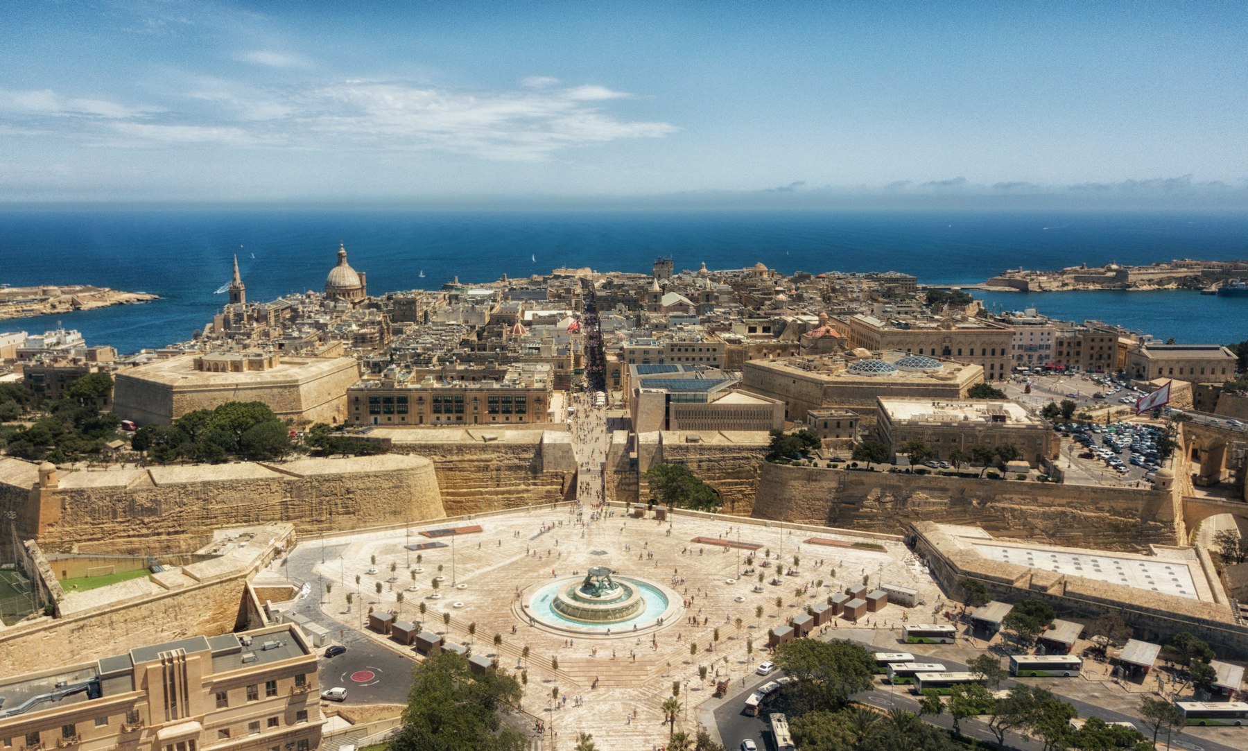
Malta is small enough to cross in an hour, but packed: three islands, three UNESCO World Heritage Sites and a coastline that changes every few kilometres. This interactive map of Malta, built by us at Experiences Malta, pins more than 50 beaches, sights, churches, dive sites, restaurants and hotels from our guides in one place. Filter by what you want to do, switch between Malta, Gozo and Comino, or tap Near me to see what is closest to you right now.
Islands
Malta, Gozo and Comino
Total area
About 316 km²
Malta to Gozo
About 25 minutes by ferry
On the map
Beaches, sights, food and more
Interactive Map of Malta, Gozo and Comino
Every pin links to the guide where we cover that place in depth, plus one-tap directions. We add new places as we write new guides.
Blue Grotto
Sea caves and a 30-metre arch reached by small boats from Wied iż-Żurrieq. Best on a calm morning.
Blue Hole
A natural pool in the rock opening into an arch, next to the remains of the Azure Window.
Blue Lagoon
Malta's most famous turquoise water, between Comino and Cominotto. Visitor numbers are managed with a booking system.
Buġibba jetty
Departure point for shorter day cruises to Comino from the St Paul's Bay resorts.
Ċirkewwa Marine Park
Shore dives on the reef, a cave and the wrecks of the tug Rozi and the patrol boat P29.
Cittadella, Victoria
Gozo's walled hilltop citadel, with the cathedral, the Old Prison and views across the island.
Comino Ferries, Ċirkewwa
The Comino ferry kiosks next to the Gozo ferry terminal. Boats to the Blue Lagoon take about 20 minutes. About €15 return.
Commando
Mediterranean cooking at moderate prices near Mellieħa Bay.
Crystal Lagoon
Clear water below the cliffs on Comino's west coast, usually visited by boat.
De Mondion
Fine dining on the roof of The Xara Palace, on Mdina's bastions, with views across Malta.
Dingli Cliffs
Malta's highest sea cliffs, best at sunset.
Dwejra Inland Sea
A lagoon linked to the sea by a natural tunnel, beside Fungus Rock and the Blue Hole.
Fond Għadir
Flat rock platforms and ladders on the Sliema promenade, handy if you are staying in town.
Fort St Angelo
The Knights' fortress at the tip of Birgu, facing Valletta across the Grand Harbour.
Fort St Elmo
The star-shaped fort at the tip of Valletta, home to the National War Museum.
Gardjola Gardens
A small garden at the tip of Senglea with a carved lookout over the Grand Harbour.
Ġgantija Temples
Among the oldest free-standing stone structures in the world, older than the pyramids.
Għajn Tuffieħa Bay
A wilder reddish-gold beach below clay slopes, reached by a long flight of more than 100 steps. No buildings on the sand.
Golden Bay
The best-equipped sandy beach in the north-west, with restaurants, water sports and showers. Faces west for sunsets.
Ħaġar Qim Temples
A prehistoric temple on the cliff top, part of a UNESCO World Heritage Site.
Ħal Saflieni Hypogeum
An underground prehistoric burial site cut into the rock. Only 10 visitors per tour, so book well ahead.
HMS Maori
A Second World War destroyer lying in shallow water off Fort St Elmo. Suits newer divers.
Ħondoq ir-Rummien
A cove facing Comino with clear water and a small sandy area.
ION Harbour by Simon Rogan
Tasting menus built on Maltese produce, on the rooftop of Iniala Harbour House above the Grand Harbour.
Is-Serkin
Rabat's famous pastizzi stop, a short walk from Mdina.
Legligin
A tasting run of Maltese meze dishes with local wines.
Marfa jetty
A second departure point for Comino ferries, just east of Ċirkewwa.
Marsaxlokk
The fishing village of colourful luzzu boats, with its big market on Sunday mornings.
Mdina Gate
The Baroque main gate of the Silent City, built in 1724 and seen in Game of Thrones.
Mellieħa Bay
About 800 metres of sand with shallow water, the easiest beach for young children. Lifeguards, sunbeds and water sports in summer.
Mġarr Harbour, Gozo
Gozo's ferry port. Boats to the Blue Lagoon take about 15 minutes, from about €13 return.
Mġarr ix-Xini
A narrow inlet at the end of a valley, guarded by an old watchtower, with a small café.
Mnajdra Temples
Three temples above the sea; the south temple is aligned with the sunrise at the equinoxes and solstices.
Noni
Modern cooking with Mediterranean and French influences on Republic Street.
Paradise Bay
A small sandy cove near the Gozo ferry terminal at the northern tip of Malta.
Popeye Village
The film set of Popeye (1980) on Anchor Bay, now a family attraction.
Ramla Bay
Gozo's best-known beach: red-orange sand, a dune behind and almost no development.
Rotunda of Mosta
The Mosta Dome, modelled on the Pantheon. A German bomb pierced the dome in 1942 and did not explode.
Rubino
Traditional Maltese cooking at moderate prices in the heart of Valletta.
Santa Maria Caves
Shallow caverns and tunnels full of light, good for divers and snorkellers.
Santa Marija Bay
A quieter sandy bay about 15 to 30 minutes' walk from the Blue Lagoon. No Blue Lagoon pass needed to walk there.
Santa Marija Tower
A watchtower built in 1618, the walk-up highlight of Comino.
Sliema Ferries
The Strand in Sliema, where the ferry to Valletta leaves and most day cruises to Comino depart.
St George’s Bay
A small sandy town beach a short walk from the St Julian's hotels and Paceville.
St John’s Co-Cathedral
The Knights' church, gilded from floor to ceiling inside, with Caravaggio's Beheading of Saint John the Baptist in the Oratory.
St Paul’s Catacombs
Underground burial complexes in Rabat, a short walk from Mdina.
St Paul’s Cathedral, Mdina
Rebuilt in Baroque style by Lorenzo Gafà after the 1693 earthquake, at the heart of the Silent City.
St Paul’s Shipwreck Church
A Baroque parish church dedicated to St Paul's shipwreck on Malta, with a relic of the saint.
St Peter’s Pool
A natural rock pool with flat ledges and very clear water. No lifeguards and no shade, so bring water and a hat.
Ta’ Pinu Basilica
Gozo's national shrine, standing alone in the countryside near Għarb. Consecrated in 1932.
Tartarun
Fish and seafood in Malta's best-known fishing village.
Tarxien Temples
A prehistoric temple complex a short walk from the Hypogeum.
Terrone
Fish and seafood in the Three Cities, across the Grand Harbour from Valletta.
The Grand Hotel, Gozo
Steps from the Mġarr ferry, with sea views and Level Nine, a MICHELIN-listed restaurant.
The Palace, Sliema
A modern hotel a short walk from the Sliema seafront and the ferry to Valletta.
The Phoenicia Malta
A grand hotel just outside Valletta's City Gate, with gardens and a pool overlooking Marsamxett Harbour.
Um El Faroud wreck
A 115-metre tanker scuttled as an artificial reef in 1998, one of the Mediterranean's best-known wreck dives.
Under Grain
Fine dining downstairs at the Rosselli hotel, with the good-value Grain Street upstairs.
Upper Barrakka Gardens
Arcaded gardens with the best view over the Grand Harbour and the Three Cities. The Saluting Battery fires the noon gun.
Wied il-Għasri
A narrow gorge with a tiny stony beach and excellent snorkelling on calm days.
Xlendi Bay
A narrow inlet between cliffs with a small beach and waterfront restaurants.
Xwejni Salt Pans
Chequered sea-salt pans cut into the rocks along the north coast.
How to Use the Malta Map
- Filter by type: tap Beaches, Sights, Churches, Food, Dive sites or Stay to show only those pins.
- Choose an island: switch between Malta, Gozo and Comino.
- Find places near you: tap Near me and allow location. The list re-sorts by distance, nearest first. Your location stays in your browser and is never sent to us.
- Get directions: each place has a Directions link that opens Google Maps with the route.
- Read more: every place links to our full guide, with opening times, prices and tips.
Malta’s Regions at a Glance
Malta is a group of islands rather than one: the main island of Malta, greener and quieter Gozo to the north-west, and tiny Comino in between. This is how the map breaks down.
| Region | Main places | Best for | Our guide |
|---|---|---|---|
| Valletta and the Grand Harbour | Valletta, Floriana, the Three Cities | History, churches, harbour views, fine dining | Valletta, Three Cities |
| Sliema and St Julian’s | Sliema, St Julian’s, Gżira | Hotels, restaurants, nightlife, rock swimming | Where to stay |
| The north | St Paul’s Bay, Mellieħa, Golden Bay | Sandy beaches, Popeye Village, the Gozo ferry | Beaches |
| The centre and west | Mdina, Rabat, Mosta, Dingli | The Silent City, the Mosta Dome, cliffs at sunset | Mdina and Rabat |
| The south | Marsaxlokk, Qrendi, Wied iż-Żurrieq | Temples, the Blue Grotto, the Sunday fish market | Temples |
| Gozo | Victoria, Xagħra, Xlendi, Dwejra | Countryside, the Citadel, diving, red-sand beaches | Gozo |
| Comino | Blue Lagoon, Santa Marija Tower | The famous turquoise water, coastal walks | Comino |
Getting Around Malta
- Buses cover the whole of Malta and Gozo, with Valletta as the main hub. Plan routes on the Malta Public Transport site.
- Ferries link Sliema and the Three Cities to Valletta, and Ċirkewwa to Mġarr in Gozo. See our Gozo ferry guide.
- Boats to Comino leave from Ċirkewwa, Mġarr and the resorts. Compare them in Malta boat trips.
- Driving: Malta drives on the left. A car is useful for Gozo and the south, but parking in Valletta and Sliema is hard.
- Ride-hailing apps are widely used and handy in the evenings.
Planning a route? Our 3, 5 and 7-day Malta itinerary strings these places together day by day, and the weather guide shows the best months for beaches.
Malta Map FAQ
How big is Malta?
The three islands cover about 316 km² in total. The main island of Malta is about 246 km², Gozo about 67 km² and Comino about 3.5 km².
Can you get around Malta without a car?
Yes. Buses reach most towns and beaches, ferries cross the harbour and to Gozo, and ride-hailing apps fill the gaps. A car makes Gozo and the south easier.
Where are the sandy beaches on the map?
Most are in the north and north-west of Malta, around Mellieħa and Golden Bay, plus Ramla Bay on Gozo. Filter the map by Beaches to see them all.
How do I get from Malta to Gozo?
The car ferry from Ċirkewwa to Mġarr takes about 25 minutes and runs all year. A fast ferry also sails from Valletta.
Does the Near me button store my location?
No. Your browser works out the distances on your device. Your location is not sent to us or saved.

How we wrote this guideThis guide was researched and written by us at Experiences Malta, using the official and local sources listed below, and we review it through the year. Prices, timetables and opening hours change, so please check before you travel. More about Experiences Malta.
Sources: Geography of Malta (Wikipedia), OpenStreetMap, Malta Public Transport, Gozo Channel.